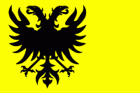
Naarden (Gemeente Naarden)
 |
 |
Naarden was granted its city rights in 1300 (the only town in the Gooi with these rights) and later developed into a fortified garrison town with a textile industry.
Naarden is an example of a star fort, complete with fortified walls and a moat. The moat and walls have been restored on numerous occasions, most notably during the French era (1795-1814). After the Battle of Leipzig (1813), the Netherlands were liberated by an allied force of Dutch, Prussian and Russian armies. During this period, Naarden was besieged for months since the French commander didn't believe that Napoleon was captured. In May 1814, the French soldiers left the city in a retreat with honour (see Siege of Naarden (1813-1814).
John Amos Comenius, 17th century Moravian born Czech educator was buried in the city, and his mausoleum is open for visitors.
Despite its earlier importance, Naarden's population was surpassed by Hilversum in the 18th century and today it is smaller than its neighbour Bussum.
The city's distinctive shape made it a rallying point for Allied bombers returning to England after raids on Germany.
Naarden was a separate municipality until 2015. On 1 January 2016, the municipality of Naarden merged with Muiden and Bussum to form the new municipality of Gooise Meren.
Map - Naarden (Gemeente Naarden)
Map
Country - Netherlands
 |
 |
The four largest cities in the Netherlands are Amsterdam, Rotterdam, The Hague and Utrecht. Amsterdam is the country's most populous city and the nominal capital. The Hague holds the seat of the States General, Cabinet and Supreme Court. The Port of Rotterdam is the busiest seaport in Europe. Schiphol is the busiest airport in the Netherlands, and the third busiest in Europe. The Netherlands is a founding member of the European Union, Eurozone, G10, NATO, OECD, and WTO, as well as a part of the Schengen Area and the trilateral Benelux Union. It hosts several intergovernmental organisations and international courts, many of which are centred in The Hague.
Currency / Language
| ISO | Currency | Symbol | Significant figures |
|---|---|---|---|
| EUR | Euro | € | 2 |
| ISO | Language |
|---|---|
| NL | Dutch language |
| FY | West Frisian language |


